|
Eclipse Reveals
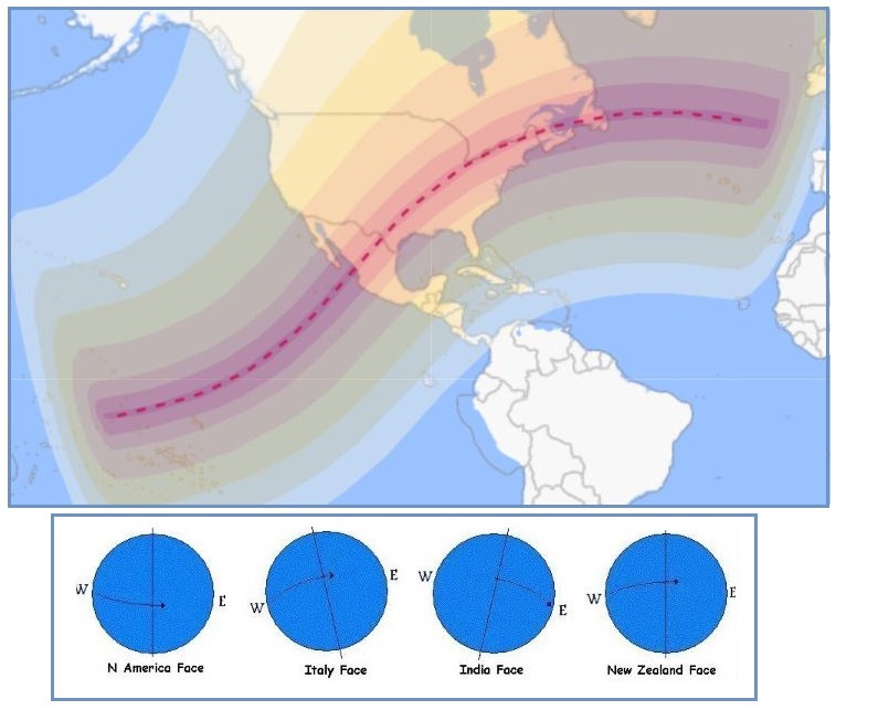
The day before the Eclipse there was a sense of anticipation
from insiders, who knew that NIbiru could be revealed. The path
of Totality covered a part of the Pacific and Mexico and then
along the New Madrid Fault Line to the Seaway Exit. During this
time the Daily Earth Wobble completes the Lean to the West and
the Bounce Back. Thus the time when a photo is taken or the
perspective of the viewer determines where Nibiru might emerge.
This can also be seen in the direction the Moon takes when
occulting the Sun.
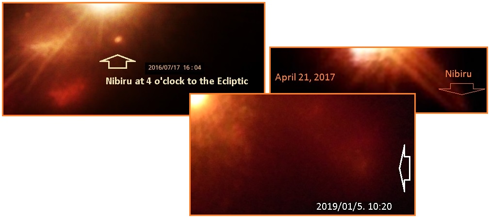
Nibiru is normally found at the 4 o’clock position to the Sun in
the Northern Hemisphere, but the Daily Earth Wobble can sling it
from the 2 o’clock to the 7 o’clock position. Nibiru’s diameter
is 4-5 larger than the Earth or Venus, but it is shrouded by a
dense Red Dust cloud composed of Iron Oxide particles that cling
to the Nibiru magnetism. There is Petrol in the mix, collected
from all the life bearing water planets in the Asteroid Belt
that were smashed to pieces when Nibiru passed through. When the
angle is right, primarily at dawn and dusk, this dust cloud
reflects sunlight giving the appearance of a Second
Sun in the sky, as large as the Sun itself.
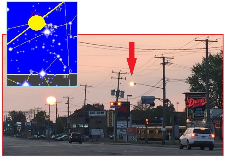
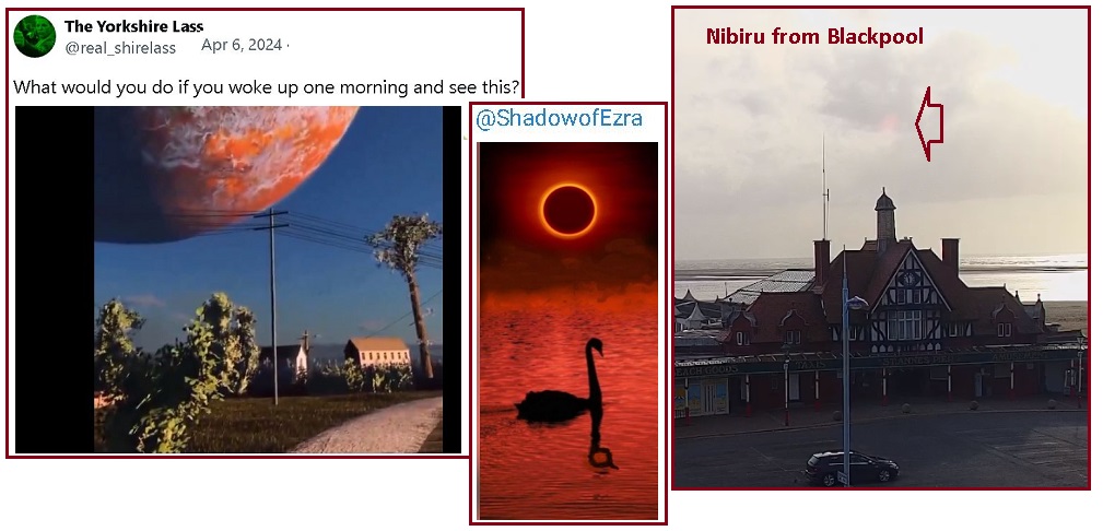
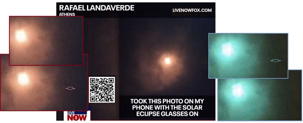
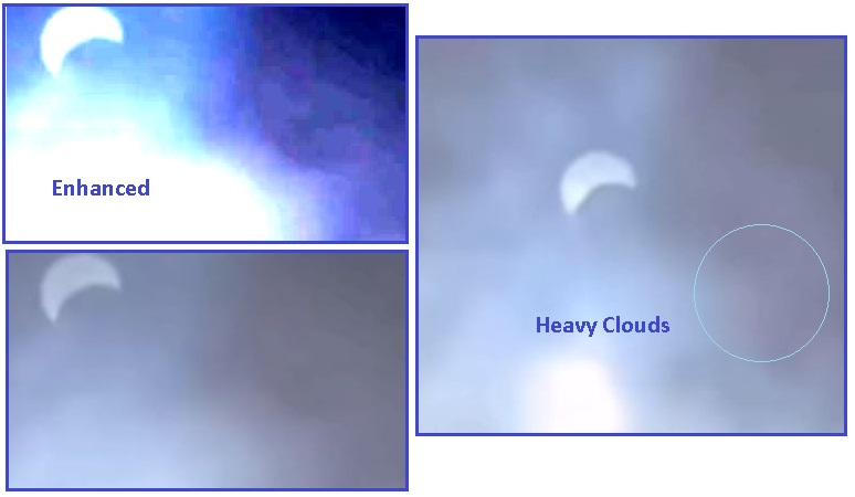
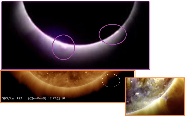
That said, there were several photo captures of Nibiru in its
actual size during the April 8 Eclipse. Fox
News inadvertently captured this at the 4 o’clock position
to the Sun. When enhanced
the body of Nibiru can be clearly seen.

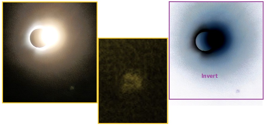
There were additional excellent photos showing the real
size of Nibiru. Alberto captured the true
size in 2017, showing the vast Red Dust cloud blowing to
the left as Nibiru has a Retrograde
Rotation, turning clockwise.
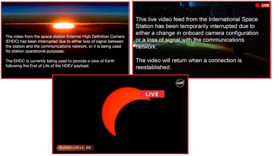
There were attempts to prevent the public from discovering
Nibiru. Chem trails
were out in force. NASA announced that an anticipated live
stream from the ISS had technical issues. CME’s from
the Sun did not occur so this was not used as an excuse.
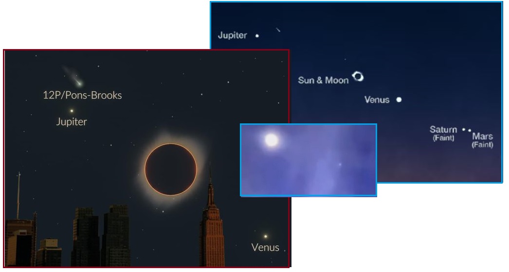
And the Devil Comet P12 was too far away to the upper left near
Jupiter so could not be claimed.

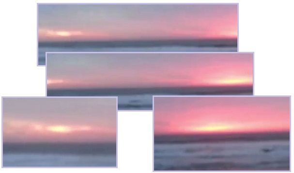
But Venus
made an appearance during the Eclipse, becoming somewhat
more visible when the Sun's glare is reduced, as did the Dark
Twin when the camera is pointing West.
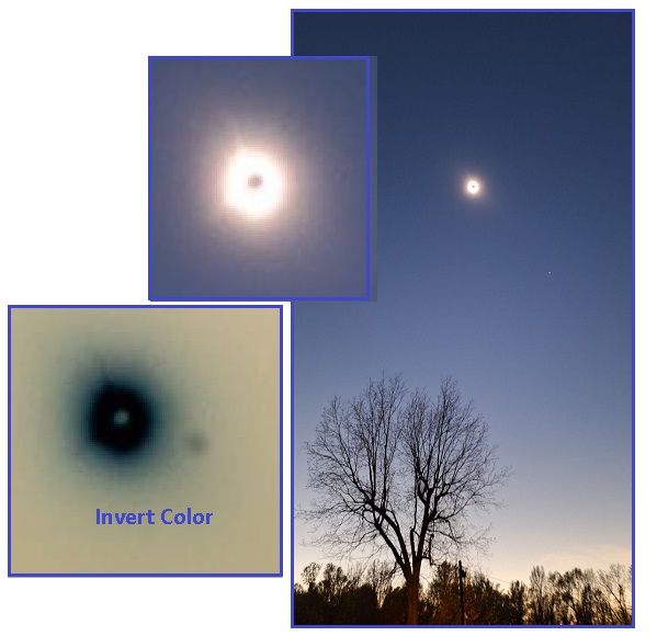
The location of Nibiru can also be determined by the appearance
of a large mass during the eclipse, as the dust cloud is vast. A
TicTock video confirms this vast dust shrouded
mass off the 4 o'clock position is Nibiru. An excellent
private photo from Tennessee shows upon inverse color a large
shrouded object the expected size of Nibiru at the 4 o'clock
position! This big fuzz ball is at quite a distance from the
Sun, not tucked into the Corona, so is likely overlooked as the
location
of Nibiru.
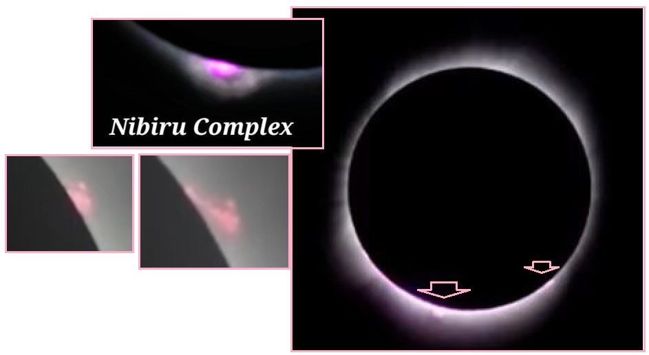
James, one of the ZetaTalk Followers photographers, normally
enhances his captures for the Pole
Shift ning to bring out the Nibiru Complex. So his Eclipse
video comes enhanced. The video shows that Nibiru and its
two Dominant Moons do not move, just as the Sun and Moon do not
Move, but the clouds move along.
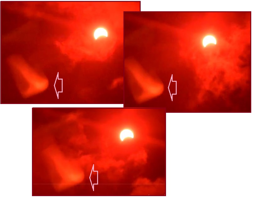
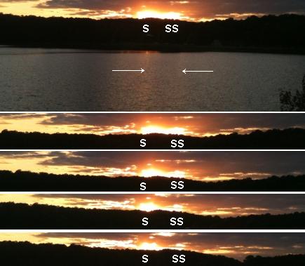
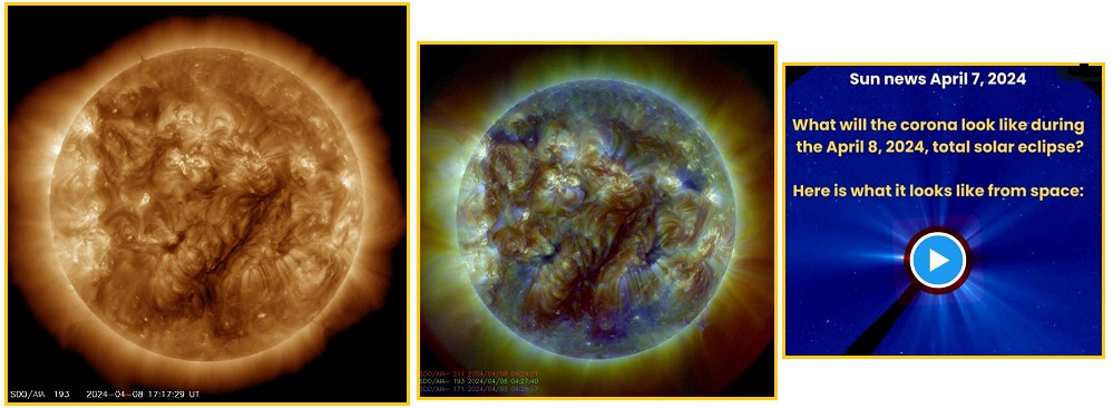
From the start of the Eclipse day what was obvious were the many
Moons in the vast tail of Nibiru. When they showed up along
the Corona they were round and usually pink, but
distinctly obvious. NASA reacted to this visibility by reducing
what could be seen on their live stream to two colors – orange
and black. When asked what all the pink below the Sun was by TV
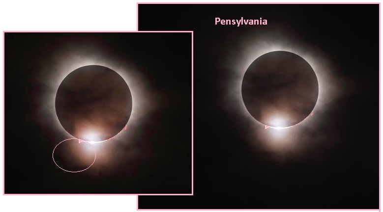
talking heads, NASA had no answers. TheRealPax
Live Stream available earlier in the day did not play
those games. Thus a photo from Pennsylvania
showed pink Moons.
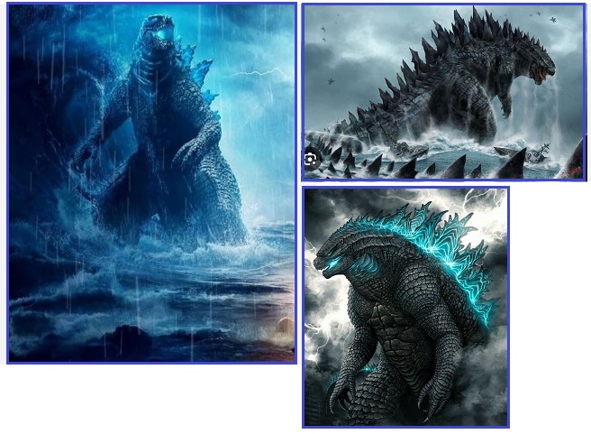
Godzilla Rises
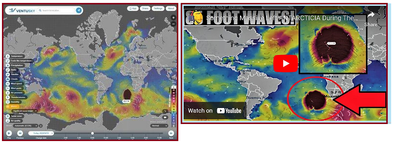
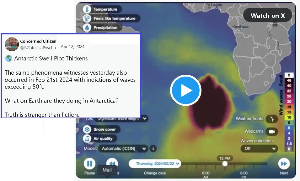
No one knew what to make of it. The Antarctica
border was showing 83.4 foot high waves! Was it a storm?
None were present. Was it an asteroid that snuck past all the
surveillance the Space Force and ISS had in place? Perhaps it
was Godzilla,
rising from the cold depths of the S Atlantic, or CERN, or a
submarine iceberg.
NOAA
automatically computed where this ‘storm’
would travel up along the Atlantic, and announced that Europe
should brace for 80+ foot high waves. But since no storm
was in sight, they quickly declared that prediction a quirk and
canceled the warning.
ZetaTalk Answer
4/11/2024: Zetas
Right Again! In 1999 we predicted that as the Pacific
compressed it would put pressure on the Antarctica Plate on
the Pacific side causing Antarctica to nose up between the tip
of S America and the tip of S Africa, forming New
Land there. Where this process has just started, the
rising land mass caused a huge displacement of the S Atlantic
waters. A displacement can act like a tsunami if directed in a
particular direction, but if not directed will throw the water
into the air, which is what happened on April 10.
Zetas to the rescue, and Zetas RIGHT Again! At the start of the
ZetaTalk saga the Zetas predicted that a compressing Pacific
would put pressure on the Antarctica Plate so that it would tilt
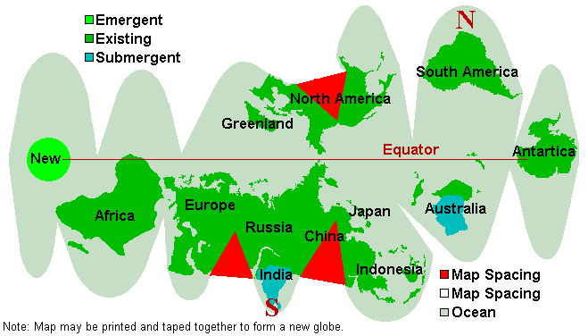
and pop up in the S Atlantic, eventually forming New
Land. Thus the New
Geography map shows this location for New Land. This is a
displacement wave, from the ocean floor suddenly rising at that
location. Not a tsunami, as it is not a tilted ocean floor, but
just a lot of water that must promptly splash away.

ZetaTalk Prediction
2/15/1999: The
Antarctic plate finds the side abutting the Pacific under
pressure, as the plates due to fold or crumble or subduct in
the Pacific begin to do this. This in effect is forcing the
Antarctic plate to fold itself, like a fan, and it resists
this pressure to fold. The tendency is rather for the
Antarctic plate to break away from these bordering plates, so
it then becomes free to move. Likewise, along the Atlantic,
the spreading plates in the Atlantic are asking the Antarctic
plate to rip apart, which it resists, being a very solid
plate. The point that gives, the weak point, is the border
between the Antarctic plate and those in the Atlantic, as
these are already weakened points. Thus, these weak points
separate, the Atlantic plates going their way, the Antarctic
staying in place.
The Antarctic plate is now
free on all sides! The overlapping and compressing plates on
the Pacific side represent pressure and push. The
separating and spreading plates on the Atlantic side represent
an opening, so the Antarctic plate moves in that
direction. Freed of tight borders, it is free to float or sink
in the sea of lava that all plates ride upon, and as a land
plate, being lighter than those that have sunk under the deep
seas, it floats - new land! There are contours on plates,
below water, just as there are contours above water. The
portion of the Antarctic plate that emerges above the waves is
higher than the rest of the Antarctic plate. Thus, the new
land and existing Antarctica are not joined.
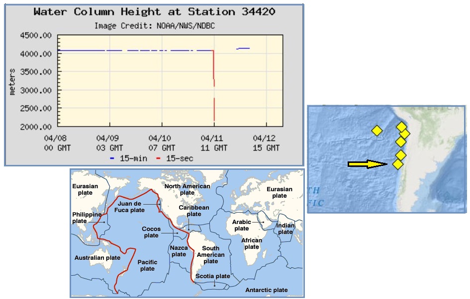
Rising and falling plates under the sea should be expected. Even
the spot where 83.4 foot waves occurred in the S Atlantic had a
similar though smaller wave episode in February, 2024. A buoy
off coast
of Chile recently, where the Nazca and Pacific plates are
overlapping and compressing, lost 6,000 foot (2,000 meters) of
water suddenly. Where did the water go?
SE on the Move
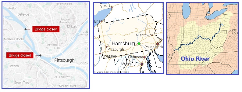
Water Jolts in the SE Portion of N
America (which is separating from the Mainland Portion as the
New Madrid Fault Line Finale proceeds) are happening repeatedly
over the past weeks. First there was the Baltimore
Bridge crash when a container ship struck the bridge on
March 25. The second was a Barge on the Arkansas River on March
30. Then a bridge in New
York City was struck on April 5 when a cargo ship lost
power. Now on April 13 some 26 barges on the Ohio River
headwaters near Pittsburg broke free from their mooring. Only a
jolt would cause the moorings to break. All these accidents were
caused by sudden jolts in the water, per the Zetas, a sign that
the SE Portion was on the move!
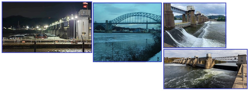
- Officials Rush to Shut Down McKees
Rocks Bridge after 23 Barges Break Free in Pittsburgh
April 13, 2024
https://www.dailymail.co.uk/news/article-13303779/Officials-shut-McKees-Rocks
- Authorities have been forced to
close down the McKees Rocks Bridge after 23 barges
reportedly broke free from a tugboat on
the Ohio River.
- 26 Barges Break Loose and Float down
Ohio River, causing Damage and Prompting Bridge Closures in
Pittsburgh
April 13, 2024
https://www.cnn.com/2024/04/13/us/pittsburgh-barges-bridges-ohio-river
- A marina in Pittsburgh sustained
extensive damage after 26 barges, most of which were
loaded with dry cargo, broke loose late Friday night and
floated uncontrolled down the Ohio River. Two
Pittsburgh-area bridges about 2.5 miles apart were closed
after the barges broke free. The West End Bridge was also
closed in both directions and rail traffic was shut down
on the rail bridge to Brunot Island. No hazardous
materials were on board the barges. Of the 26 loose
barges, 23 were loaded and carrying dry cargo, including
coal. Eleven of the barges were located and pinned against
the river bank by Brunot Island. They were being held by a
tugboat. Meanwhile, 14 continued down the river and six
have gone over the Emsworth Dam.
Where Pittsburg is near the start of the Ramapo Fault Line it
does not extend that far to the West. Pittsburg is also just
below the point where the New Madrid Fault Line runs under the
Seaway.
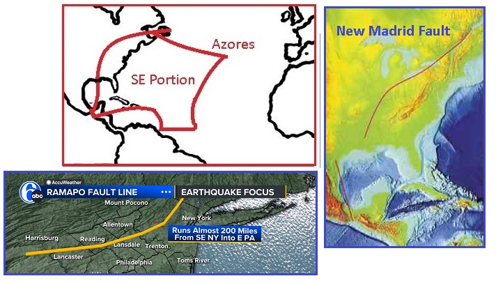
- Ramapo Fault
https://en.wikipedia.org/wiki/Ramapo_Fault
- The Ramapo Fault zone is
a system of faults between the
northern Appalachian Mountains and Piedmont
areas to the east. Spanning more than 185 miles
(298 km) in New York, New Jersey,
and Pennsylvania, it is perhaps the best known fault
zone in the Mid-Atlantic region, and some small
earthquakes have been known to occur in its vicinity.
ZetaTalk Confirmation
4/13/2024: As
we have explained repeatedly, a plate jolt to objects on water
does not have a brake. Thus anything on the water will
continue to move on the path the jolt pushed it into, unlike
objects on land which will be grounded and thus stop moving.
Friction with the land is the brake. The SE Portion is being
jerked to the SE, along with Africa when it rolls, and these
jerks have only started. It may be rivers and lakes and bays
that are a concern now, but quake devastated cities and
highways will be next. This is the New Madrid Adjustment, now
starting.
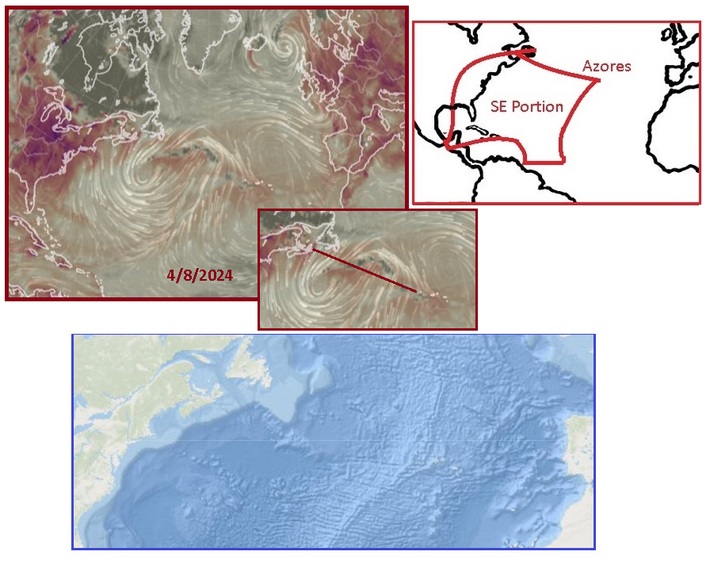
The separation of the N America Portions has been ongoing since
2019, running up from the Isthmus through the Gulf and thence up
the Mississippi River and under the Seaway. Recently it has been
obvious that the only stretch remaining to separate was from the
Seaway Exit to the Azores. The Dark Gray areas on the Burn Maps
are where no Methane can be sensed - a rip free zone. Note that
the New Madrid Fault Line running from the Seaway Exit to the
Azores is almost completely Dark Gray by April 6.

On April 8 we see that the Dark Gray area on the Burn Map shows
the full extent from the Seaway Exit to the Azores. The red from
burning Methane being released due to ripping is absent because
the Mainland and SE Portions have separated from each other. The
SE Portion is now able to slide with Africa during its roll.
|